Atiku
The Northern and Arctic Studies Portal
Search results
7 to 6 on 16 2 of 3
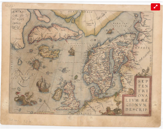
Cartes anciennes de l’Arctique (Université Laval)
Collection of the University Laval’s Library consisting of some twenty maps dating from the 16th to the 20th century. These documents are the work of famous cartographers such as Gerardus Mercator, Jan Jansson, Guillaume de L’Isle and Willem Blaeu, but also of explorers like Captain Joseph-Elzéar Bernier.
Subjects: Circumpolar Arctic, Maps, Cartography
- Kind
- Free - Open Access
- Access
- Open Access
- Domain
- Humanities and Social Sciences

Données Québec – Environnement, ressources naturelles et énergie (Gouvernement du Québec)
Selection of geospatial data from Quebec’s Department of Energy and Natural Resources.
Subjects: Natural Resources, Geospatial data, Energy, Cartography, Quebec
- Kind
- Free - Open Access
- Access
- Open Access
- Domain
- Engineering and Technology
- Natural Sciences
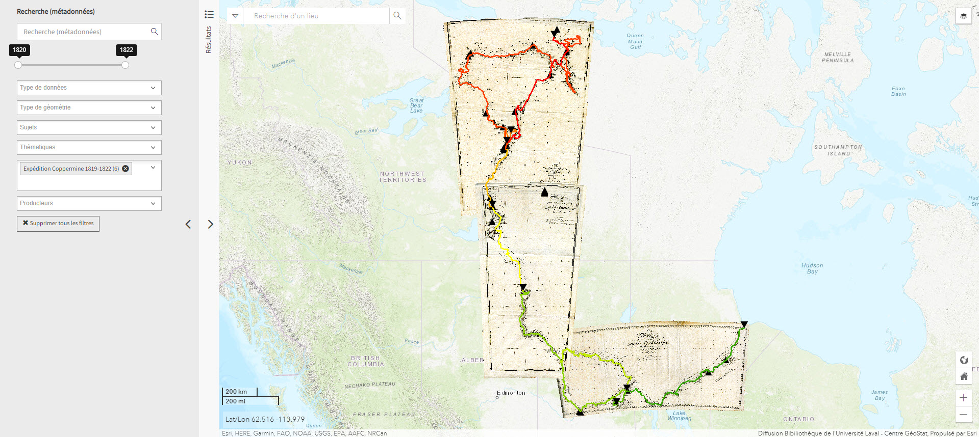
Expédition Coppermine (1819-1822) (Géoindex)
This collection of 6 layers of geospatial data is a spatial and historical reference tool on the Coppermine expedition headed by British explorer John Franklin between 1819 and 1822. An educational and research tool for the polar regions.
Subjects: Cartography, Coppermine expedition, Exploration, Geospatial data, John Franklin
- Kind
- Reserved Access
- Access
- Reserved Access
- Domain
- Natural Sciences
- Humanities and Social Sciences
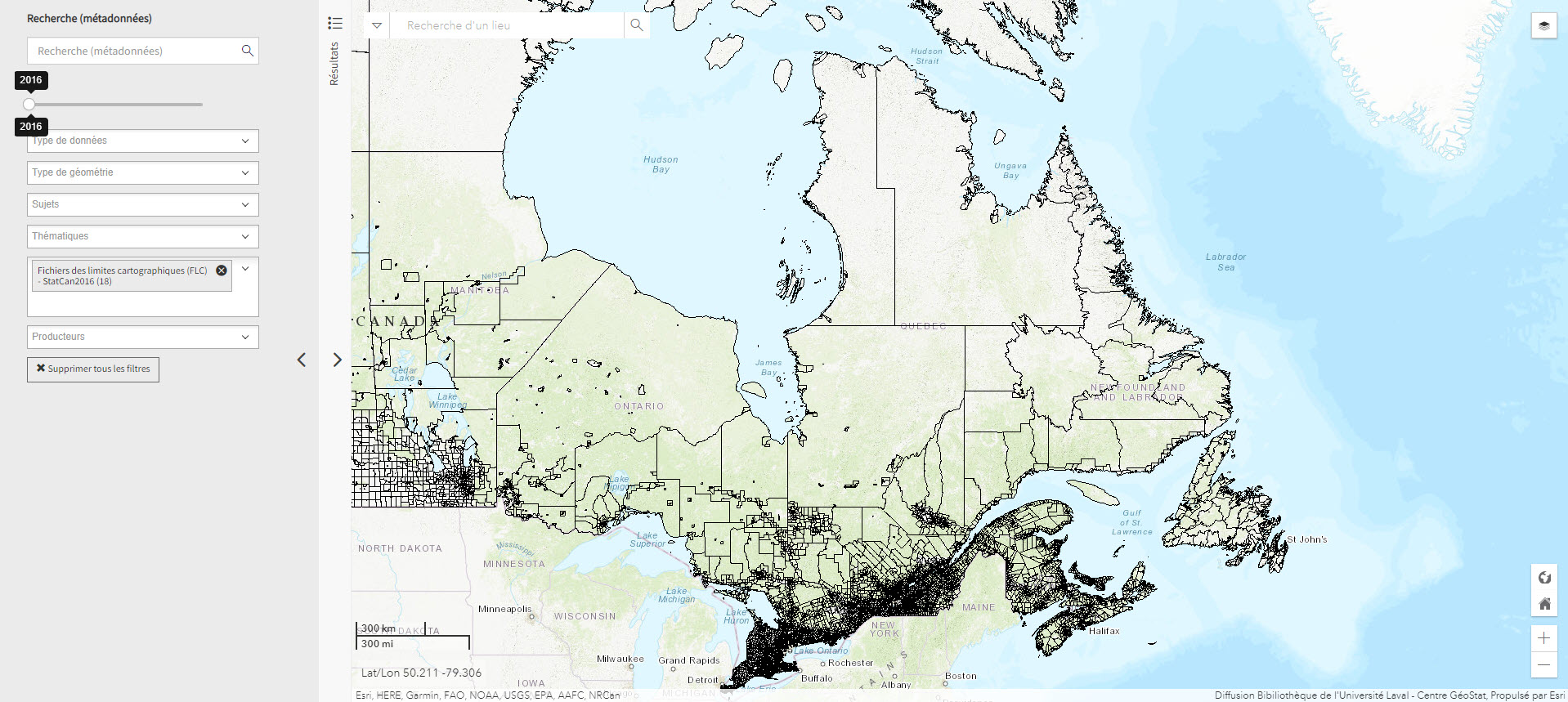
Fichier de limites cartographique de Statistiques Canada (2016) (Géoindex)
A collection of 13 layers of geospatial data representing the boundaries of census data release units by Statistics Canada. When used in conjunction with census data, these files are useful for thematic mapping.
Subjects: Cartography, Census, Geospatial data
- Kind
- Reserved Access
- Access
- Reserved Access
- Domain
- Humanities and Social Sciences
GéoInfo – Territoire nordique (Gouvernement du Québec)
Compilation of data on Northern Quebec, some of which is freely accessible.
Subjects: Geospatial data, Northern Quebec, Cartography
- Kind
- Free - Reference only
- Free - Open Access
- Access
- Open Access
- Reference only
- Domain
- Humanities and Social Sciences
- Natural Sciences

Historical atlas of the Arctic
An atlas presenting five centuries of polar exploration and mapping, from the first-ever print map of the region (Mercator, 1595) to contemporary mapping of the ocean depths using multibeam bathymetry.
Subjects: Atlas, Cartography, Discovery, Exploration, History
- Kind
- Printed document
- Access
- Print Document
- Domain
- Humanities and Social Sciences