Atiku
The Northern and Arctic Studies Portal
Search results
13 to 6 on 33 3 of 6

Cartes du Nord (Gouvernement du Canada)
Selection of Natural Resources Canada maps on coastal areas, ice, snow, permafrost, and more.
Subjects: Natural Resources, Northern Canada, Maps
- Kind
- Free - Open Access
- Access
- Open Access
- Domain
- Natural Sciences
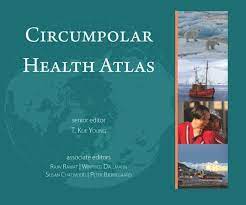
Circumpolar Health Atlas
Uses maps, tables, charts, and images to describe and explain the major health problems of the diverse peoples who inhabit the circumpolar region of the northern hemisphere.
Subjects: Social determinants of health, Atlas, Circumpolar North, Health, Indigenous peoples, Maps, Medical care
- Kind
- Printed document
- Reserved Access
- Access
- Print Document
- Reserved Access
- Domain
- Health Sciences
First Nation Profile Interactive Map (Gouvernement du Canada)
Map of Indigenous communities in Canada, with access to information about them.
Subjects: Indigenous peoples, Reserves, Maps, Band councils
- Kind
- Free - Open Access
- Access
- Open Access
- Domain
- Humanities and Social Sciences

Historical maps: Arctic (BAnQ)
Corpus of fifteen old maps dating from the 17th to the 20th century. These documents bear witness to the Arctic expeditions and explorations carried out by several generations of European explorers in search of the Northwest Passage. These documents reflect the advancement of knowledge of the Arctic coastline of North America. The information on these maps is based among other things on the discoveries of Martin Frobisher, William Baffin, etc.
Subjects: Northwest Passage, Cartography, Canadian arctic, Davis Strait, Greenland, Hudson Strait, Maps, Circumpolar Arctic, Arctic archipelago, Baffin bay
- Kind
- Free - Open Access
- Access
- Open Access
- Domain
- Humanities and Social Sciences

Historical maps: Hudson’s Bay (BAnQ)
Corpus of historical maps dating from the 17th and 18th century and allowing to visualize the territorial evolution of Hudson Bay. Their representation of Hudson’s Bay is inspired, among other things, by the explorations of Henry Hudson and Thomas James. These maps relate the French and English expeditions to this much coveted territory because of its strategic positioning for the fur trade in Europe.
Subjects: Cartography, Hudson Bay, Hudson’s Bay Company, Maps, New France
- Kind
- Free - Open Access
- Access
- Open Access
- Domain
- Humanities and Social Sciences

International Bathymetric Chart of the Arctic Ocean
Maps and bathymetric geospatial data of the Arctic north of the 64th parallel.
Subjects: Bathymetry, Maps
- Kind
- Free - Open Access
- Access
- Open Access
- Domain
- Natural Sciences