Atiku
The Northern and Arctic Studies Portal
Search results
7 to 6 on 22 2 of 4

Couche des composantes d’utilisation géographique régionale (BGR) – 2015 (Géoindex)
A collection of 24 layers that show the position and type of elements that make up Quebec’s regional geographic base, including energy facilities, ATV trails, snowshoe trails, wind turbines, etc.
Subjects: Energy equipment, Geospatial data, Regional geographic basis, Wind energy equipment, Quebec
- Kind
- Reserved Access
- Access
- Reserved Access
- Domain
- Engineering and Technology
- Humanities and Social Sciences
- Natural Sciences
Current Daily Ice Analysis (U.S. National Ice Center)
Geospatial data on ice in the Arctic and Antarctic.
Subjects: Circumpolar North, Geospatial data, Pack ice, Ice
- Kind
- Free - Open Access
- Access
- Open Access
- Domain
- Natural Sciences

Découpages socio-économiques (DSE 20K) 2017 (Géoindex)
A collection of 7 layers of geospatial data for Quebec representing certain boundaries in the fields of health, elections, education, justice, and land.
Subjects: Health, Justice, Quebec, Education, Elections, Geospatial data
- Kind
- Reserved Access
- Access
- Reserved Access
- Domain
- Humanities and Social Sciences
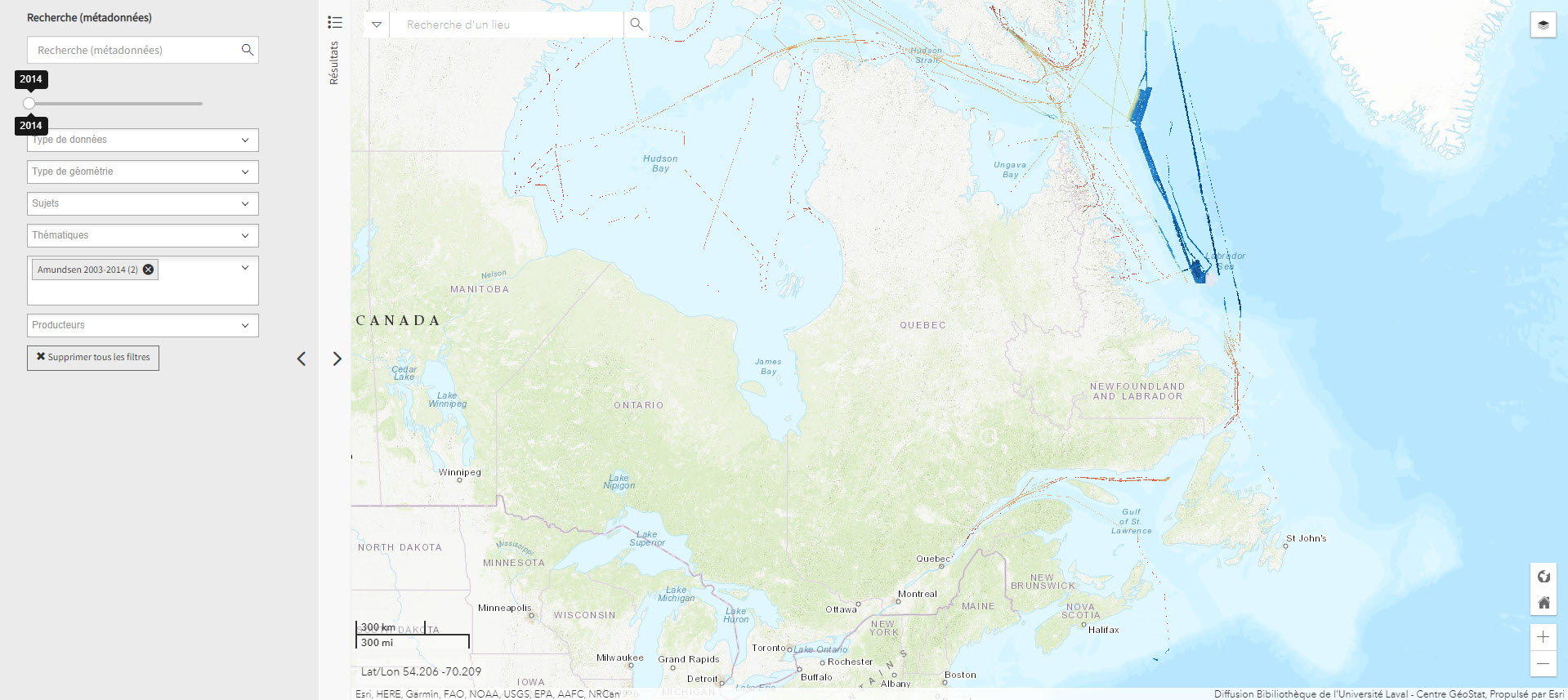
Données bathymétriques du NGCC Amundsen 2003-2014 (Géoindex)
Layer representing bathymetry data collected by the CCGS Amundsen and other scientific vessels between 2003 and 2014. Each tile covers 30 minutes longitude by 15 minutes latitude.
Subjects: Canadian arctic, Geospatial data, NGCC Amundsen, Bathymetric data, Bathymetry
- Kind
- Reserved Access
- Access
- Reserved Access
- Domain
- Natural Sciences

Données Québec – Environnement, ressources naturelles et énergie (Gouvernement du Québec)
Selection of geospatial data from Quebec’s Department of Energy and Natural Resources.
Subjects: Cartography, Energy, Geospatial data, Quebec, Natural Resources
- Kind
- Free - Open Access
- Access
- Open Access
- Domain
- Engineering and Technology
- Natural Sciences
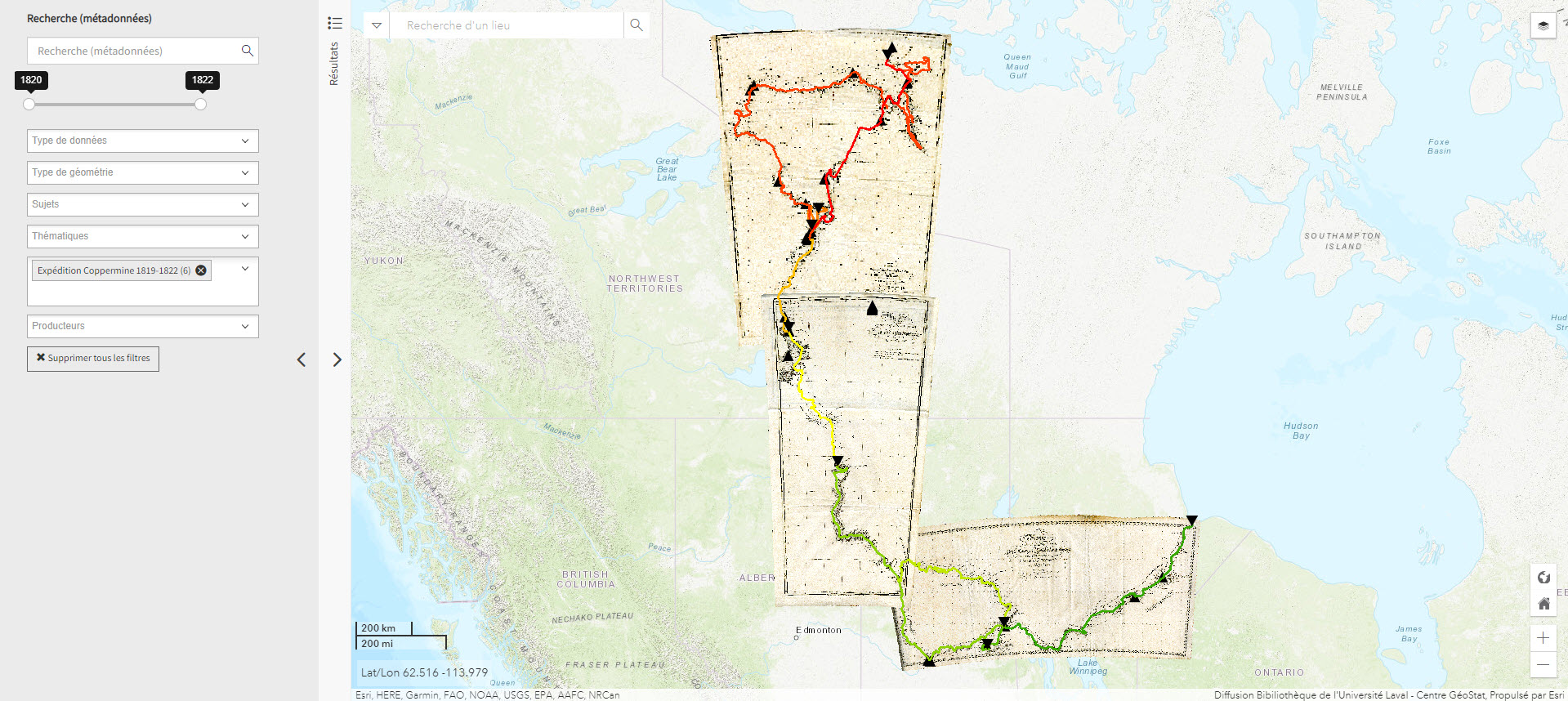
Expédition Coppermine (1819-1822) (Géoindex)
This collection of 6 layers of geospatial data is a spatial and historical reference tool on the Coppermine expedition headed by British explorer John Franklin between 1819 and 1822. An educational and research tool for the polar regions.
Subjects: Cartography, Coppermine expedition, Exploration, Geospatial data, John Franklin
- Kind
- Reserved Access
- Access
- Reserved Access
- Domain
- Humanities and Social Sciences
- Natural Sciences