Atiku
The Northern and Arctic Studies Portal
Search results
13 to 6 on 22 3 of 4
Fichier de limites cartographique de Statistiques Canada (2016) (Géoindex)
A collection of 13 layers of geospatial data representing the boundaries of census data release units by Statistics Canada. When used in conjunction with census data, these files are useful for thematic mapping.
Subjects: Cartography, Census, Geospatial data
- Kind
- Reserved Access
- Access
- Reserved Access
- Domain
- Humanities and Social Sciences
Géogratis – Index des produits géospatiaux
Access to the most common federal geospatial data for Canada, including the Arctic.
Subjects: Canada, Geospatial data
- Kind
- Free - Open Access
- Access
- Open Access
- Domain
- Natural Sciences
- Humanities and Social Sciences
GéoInfo – Territoire nordique (Gouvernement du Québec)
Compilation of data on Northern Quebec, some of which is freely accessible.
Subjects: Northern Quebec, Cartography, Geospatial data
- Kind
- Free - Reference only
- Free - Open Access
- Access
- Open Access
- Reference only
- Domain
- Humanities and Social Sciences
- Natural Sciences

Mise bas du caribou (Géoindex)
This layer shows the location of caribou calving grounds north of the 52nd parallel.
Subjects: Calving grounds, Caribou, Geospatial data, Northern Quebec
- Kind
- Reserved Access
- Access
- Reserved Access
- Domain
- Natural Sciences
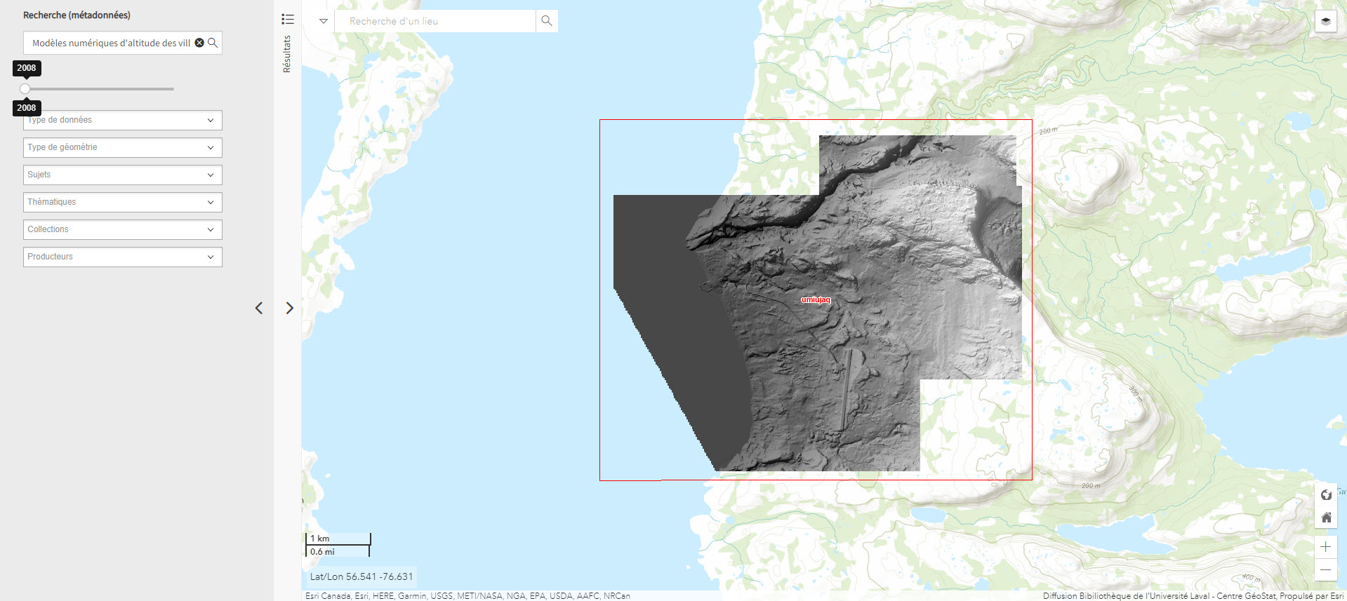
Modèles numériques d’altitude des villages nordiques à l’échelle 1/2 000 (Géoindex)
Includes digital elevation models covering Inuit villages located north of the 55th parallel. The documents in this series are digital elevation matrices accurate to within one metre.
Subjects: Digital elevation model, Geospatial data, Indigenous peoples, Inuit, Villages
- Kind
- Reserved Access
- Access
- Reserved Access
- Domain
- Humanities and Social Sciences

Parc national du Québec (Géoindex)
Layer of geospatial data representing Quebec’s provincial parks in the form of polygons, scale 1:100,000.
Subjects: Geospatial data, National parks, Quebec
- Kind
- Reserved Access
- Access
- Reserved Access
- Domain
- Natural Sciences